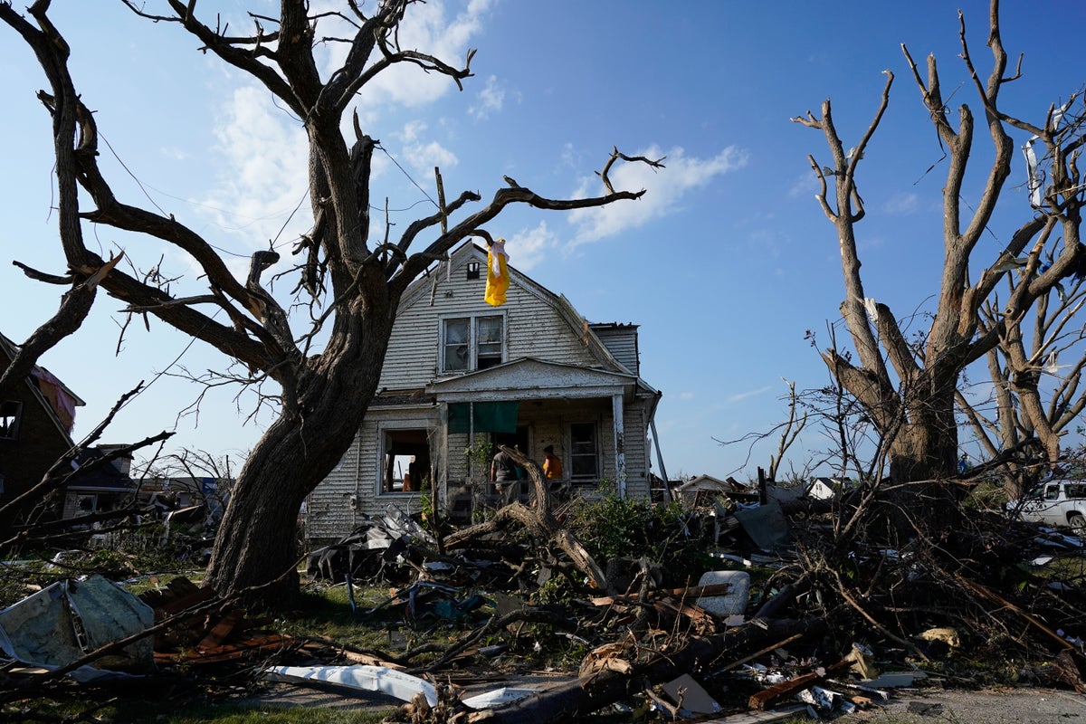
When a violent weather system tracks across the American Midwest for twenty continuous minutes, leaving a jagged scar across Wisconsin, the immediate post-disaster routine follows a predictable script. Sirens blare on cell phones. Emergency management officials hold solemn press conferences praising the speed of local first responders. Meteorologists show radar loops on local television broadcasts, pointing at bright hook echoes and purple velocity signatures that flashed on screens just moments before impact.
Then the cleanup begins. Shingles are nailed back onto roofs. Uprooted maples are dragged to curbsides. Insurance adjusters walk through shattered drywall.
Yet beneath the conventional narrative of natural disaster recovery lies an uncomfortable structural reality that rarely makes the evening news. The prolonged longevity of that twenty-minute Wisconsin tornado was not merely an act of meteorological fortune. It was a stressful test of aging infrastructure, fragmented communication lines, and a warning ecosystem that still struggles to reach populations living outside dense metropolitan grids.
Weather does not happen in a vacuum. Neither does vulnerability.
Anatomy of a Long-Track Weather Event
Meteorologists categorize long-track tornadoes by their ability to maintain ground contact over extended distances and durations, typically surviving twenty minutes or much longer while crossing multiple county lines. These atmospheric engines are fueled by severe thermodynamic instability and strong directional wind shear, creating rotating updrafts known as supercells. When a supercell organizes its internal mass rotation efficiently, the updraft and downdraft balance out, allowing the storm to feed on warm inflow air for an unusual length of time without choking off its own energy supply.
For the people on the ground in Wisconsin, however, technical classifications matter very little when structural timber begins separating from foundation bolts.
The primary danger of a long-track storm involves spatial scale. A short-lived funnel cloud gives a concentrated community a brief window to take shelter. A multi-county event turns geography into a moving target. Sirens activated in one municipality may fall silent just as the rotation crosses an invisible administrative boundary into an unincorporated township where outdoor warning coverage is thin or entirely absent.
Emergency dispatch centers often find themselves overwhelmed as citizens flood phone lines asking if the rotating cloud visible on their horizon poses an immediate threat to their specific property. This communication bottleneck exposes a persistent friction point in modern emergency management. Advanced radar can detect mesocyclone rotation miles above the earth, but translating that technical telemetry into precise, neighborhood-level warnings remains an imprecise art.
The Infrastructure Deficit in Rural Counties
Urban centers enjoy dense cellular tower arrays, automated municipal public address networks, and local media crews monitoring storms around the clock. Rural Wisconsin tells a different story.
Dead zones in cellular coverage persist across vast swaths of agricultural and heavily wooded terrain. When towers lose commercial power during the initial gust fronts of a severe squall line, backup generators do not always kick in seamlessly. If a backup fails, cell towers go dark. Residents relying entirely on smartphone weather applications suddenly lose their digital lifeline precisely when conditions deteriorate beyond safe thresholds.
Sirens present their own set of management challenges. Many rural counties rely on a patchwork of aging sirens funded by local property taxes or sporadic state grants. Some are decades old, activated by obsolete analog radio frequencies that struggle against hilly topography or heavy timber lines. A siren mounted atop a township hall twenty miles away becomes useless ambient noise to a family working inside a barn or sleeping soundly during an overnight squall.
Emergency managers know these vulnerabilities intimately. They also know the financial constraints that prevent local governments from upgrading to modern, multi-redundant alert grids. Upgrades cost millions of dollars. Small tax bases cannot absorb those capital expenditures without raising local levies to levels that residents cannot afford.
Consequently, emergency preparedness in rural areas often defaults to personal responsibility. People are expected to monitor the weather themselves, interpret radar apps on cracked screens, and make split-second survival decisions without institutional backup.
Beyond the Radar Screen
Modern meteorological reporting has become astonishingly sophisticated. Satellites capture moisture plumes from thousands of miles away. Dual-polarization radar distinguishes between falling rain and airborne debris lofted hundreds of feet into the air. Yet this scientific precision creates a false sense of security regarding how information is consumed by the public.
Data availability does not equal comprehension.
When a weather alert displays a polygon covering three entire counties, the recipient is forced to calculate risk based on probabilistic language. Is the tornado inside this polygon moving toward the north side of town or the south side? Will it track over the ridge or dissipate in the valley?
Most citizens lack the training to parse velocity couplets or reflectivity cores. When confronted with complex meteorological data, human behavior tends toward normalization bias. People assume the worst-case scenario will happen to someone else down the road. They wait for visual confirmation—watching the sky or waiting for a neighbor to text—before seeking shelter. By the time visual confirmation is achieved, the reaction window has often vanished.
This behavioral gap is where the true crisis of severe weather management resides. Technology has outpaced public education. Weather services provide granular, second-by-second updates, but the social infrastructure required to help people translate those data streams into immediate, protective action remains underfunded and neglected.
Re-evaluating Warning Architecture
Fixing this systemic vulnerability requires moving past the standard cycle of disaster, federal relief declaration, and quiet amnesia until the next storm strikes.
First, federal and state funding frameworks must prioritize rural communication hardening. Cell towers in high-risk severe weather corridors need mandatory, federally subsidized backup power systems that guarantee operation during multi-hour grid failures. Relying on commercial power availability during a category-spanning wind event is an unacceptable systemic risk.
Second, warning dissemination must evolve beyond broad geographic polygons. Automated hyper-local messaging systems that push instructions directly to devices based on precise GPS coordinates—rather than broad county-wide alerts—reduce false alarms and curb alert fatigue. When people receive constant warnings for storms that never touch their property, they eventually disable notifications altogether.
Third, local emergency management agencies need operational support to conduct continuous community education that goes beyond basic tornado drills. Understanding the structural limitations of different housing types—such as the extreme vulnerability of mobile homes and pole barns during high wind events—saves more lives than any radar upgrade ever will.
The twenty-minute Wisconsin tornado was not an unprecedented anomaly. It was a visible reminder of the physical forces constantly testing the seams of our built environment. Until infrastructure, communication networks, and warning frameworks are rebuilt to match the raw scale of these events, every severe weather season will remain a precarious gamble with rural lives.


