The salt hits your nose first, sharp and metallic, hours before the water ever reaches the asphalt.
If you have ever stood on the boardwalk in Venice or watched the morning mist burn off the cliffs in Laguna, you know the Pacific Ocean usually keeps a polite distance. It advances. It retreats. It follows a centuries-old rhythm that millions of Californians treat like background music to their morning coffee runs.
Not this week.
Along a jagged stretch of coastline from Ventura down to the Mexican border, the ocean is preparing to overstay its welcome. Meteorologists and oceanographers call them King Tides—technically perigean spring tides—when the sun, the moon, and the Earth pull into a straight line while the moon is at its closest point to our planet. To the average beachgoer, it sounds like a poetic excuse to bring a camera to the pier. To the people who live, work, and commute along the water's edge, it is a slow-motion siege.
Listen.
You can hear the difference in the surf before you see the surge. Instead of the crisp, rhythmic slap of a standard winter swell, the water develops a heavy, hollow thud. It sounds less like a wave breaking and more like a freight train coupling in the dark.
The Math Behind the Monster
To understand why a few extra feet of water can paralyze a region of twenty million people, you have to stop thinking of the ocean as a flat surface. Think of it instead as a massive, sloshing bathtub where someone just dropped a bowling ball.
Under normal conditions, Southern California experiences mixed semidiurnal tides—two high tides and two low tides every lunar day, each of slightly different heights. During a King Tide, gravitational pull stretches that water upward, pushing peak levels to seven feet or higher above the mean lower low water mark.
Seven feet. On paper, that sounds like the height of a doorway. Hardly apocalyptic.
Here is the catch: a seven-foot tide does not arrive in a vacuum. When that swollen baseline collides with a winter storm swell rolling down from the Gulf of Alaska, the two forces stack on top of each other. Add in low atmospheric pressure—which literally allows the ocean surface to bulge upward like a bruise—and suddenly you are not dealing with a high tide. You are dealing with a battering ram riding on top of an elevator.
Consider a hypothetical morning for Elena, a fictional composite of the thousands of nurses, baristas, and teachers who commute along Pacific Coast Highway before dawn. At 5:30 AM, the sky is still bruised purple. Elena turns onto PCH near Sunset Boulevard, expecting the usual trickle of brake lights. Instead, her headlights catch sheets of black water sheeting across the northbound lanes, carrying tangled ropes of kelp and fist-sized cobbles straight into the path of her tires. Saltwater does not just stall an engine; it corrodes brake lines, shorts out electrical harnesses, and turns a daily commute into a thousand-dollar tow bill before the sun even comes up.
That is the invisible reality of coastal flooding. It rarely looks like a Hollywood tsunami. More often, it looks like a creeping puddle that ruins your car, traps you in your neighborhood, and quietly rots the foundation of a beachfront apartment building from the bottom up.
Where the Water Wins First
If you want to know where the Pacific will flex its muscle hardest over the next seventy-two hours, look at the places where concrete meets sand without a buffer. Every coastal town in Southern California has its own distinct vulnerability, shaped by geography, history, and how aggressively developers built toward the surf line in the twentieth century.
The Low-Lying Peninsulas of Orange County
Walk down to the Balboa Peninsula in Newport Beach during a peak high tide, and you will witness a bizarre optical illusion. From the bay side, the water does not just lap against the seawalls; it sits visibly higher than the manicured lawns and living room floors just yards away.
Newport Beach and neighboring Sunset Beach are built on sandbars—narrow strips of land pinched between the open ocean and tranquil back bays. When the King Tide surges, water attacks from both directions. Waves overtop the oceanfront berms, while harbor water backs up through storm drains designed to empty into the bay, turning street grates into bubbling geysers. Public works crews spend days ahead of these events piling sandbags into long, snaking walls along the boardwalk, trying to hold back millions of gallons of seawater with burlap and shovels. Sometimes it holds. Sometimes a single rogue set of waves breaches the line, turning quiet residential cul-de-sacs into saltwater canals within minutes.
The Narrow Bottlenecks of Los Angeles County
Move north into Los Angeles County, and the threat shifts from quiet inundation to violent impact.
In Malibu, homes sit perched on wooden pilings and concrete caissons driven directly into the beach sand. During standard tides, those pilings stand dry and weathered above the surf. During a King Tide combined with a west-northwest swell, exploding whitewater slams directly into the undersides of decks and floorboards. The vibration rattles dishes in kitchen cabinets three stories up.
Farther south, the Venice Canals and Marina del Rey face a quieter, equally stubborn problem. The historic canals—originally dug over a century ago to mimic Italy—rely on tidal gates to regulate water levels. When the ocean outside surges past the seven-foot mark, drainage slows to a crawl. Meanwhile, along the Venice boardwalk and Hermosa Beach, wide sandy beaches that usually absorb wave energy disappear completely under water, allowing waves to run straight up to the concrete retaining walls and spill onto bike paths and storefronts.
The Crumbling Bluffs of San Diego County
Down in San Diego, the battle is vertical.
From Oceanside and Encinitas down through Del Mar and Sunset Cliffs, the coastline is defined by steep, sedimentary bluffs topped with multimillion-dollar homes and the vital LOSSAN rail corridor—the second-busiest intercity passenger rail line in the United States.
These cliffs are not solid granite. They are compressed layers of ancient sandstone and siltstone, held together by friction and luck. Under normal conditions, a wide apron of sand protects the base of the bluffs from the waves. During a King Tide, the ocean swallows that protective sand whole. Waves pound directly against the soft base of the cliffs, carving out notches like a lumberjack swinging an axe at the bottom of a pine tree.
I remember standing near the edge of a coastal bluff in Del Mar a few winters back, watching a similar winter surge eat away at the cliff face. You could actually feel the ground shudder through the soles of your boots every time a heavy wave detonated twenty feet below. Weeks later, a section of that very bluff collapsed onto the tracks, shutting down rail service between San Diego and Los Angeles for months. The ocean rarely collects its debt all at once; it weakens the foundation in January and claims the cliff in March.
The Exposed Harbors of Ventura and Santa Barbara
At the northern end of the bight, Ventura and Carpinteria sit directly in the crosshairs of winter swells funneling through the Santa Barbara Channel.
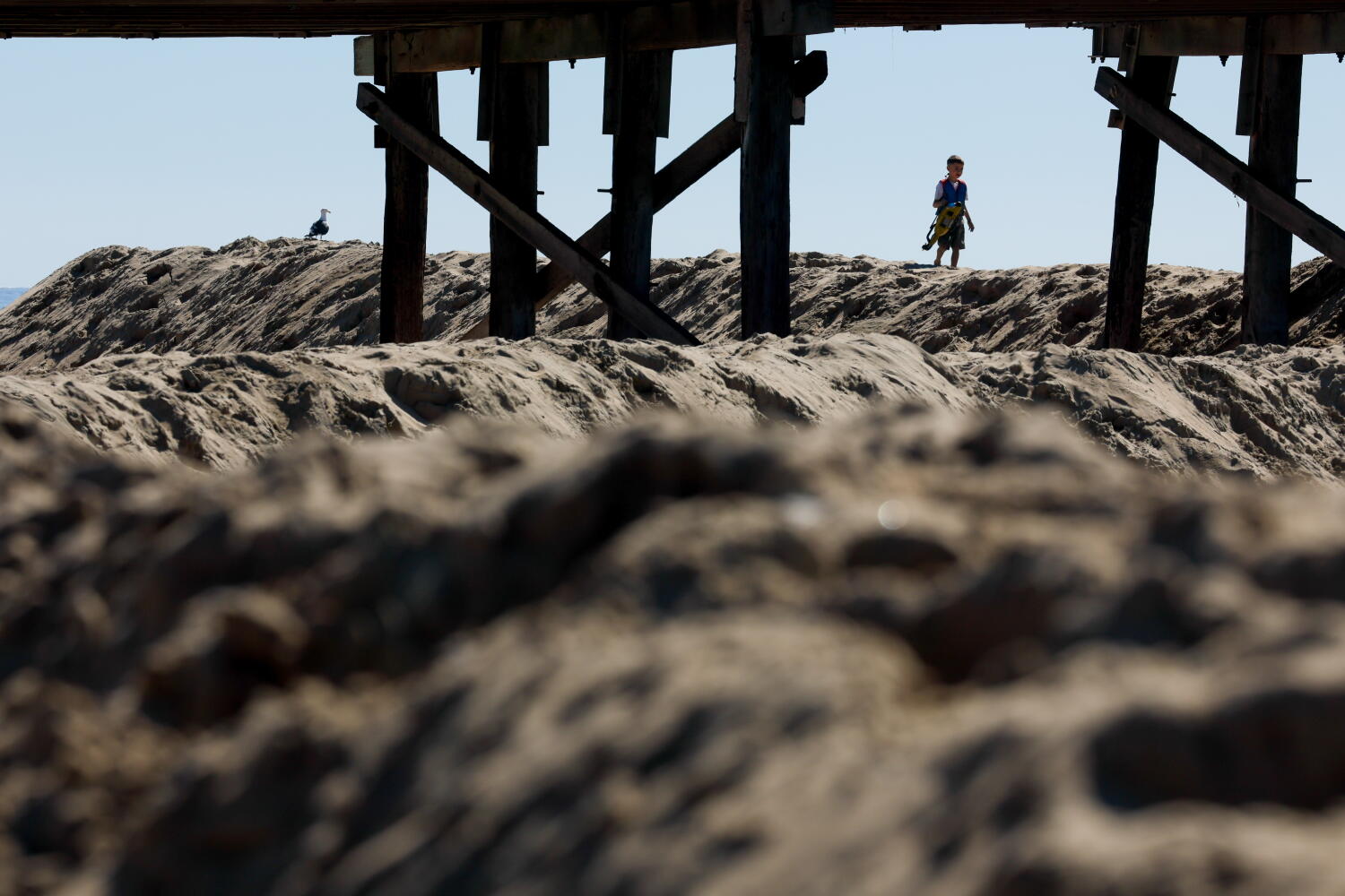
In Ventura, the pier and the surrounding promenade have taken repeated beatings over the last several winters, losing wooden pilings and planks to massive surges. Just down the coast in Carpinteria, residents rely on a massive, man-made winter sand berm—a towering wall of bulldozed sand built every autumn to protect beachfront neighborhoods. During a peak King Tide, bulldozers work around the clock, scraping wet sand back up the beach as fast as the ocean drags it out, a modern-day Sisyphus operating a Caterpillar tractor under floodlights.
The Dangerous Allure of the Spectacle
Here is the part that keeps lifeguards awake at night: high tides do not look scary from a distance. In fact, they look magnificent.
Social media feeds inevitably fill up with dramatic photos of waves exploding over piers, foam swirling around palm trees, and surfers paddling out into churning, chocolate-brown water. People drive down to the coast specifically to watch the show. They walk out onto wet rocks in La Jolla to snap selfies with the spray. They let their kids run along the edge of receding waves in Manhattan Beach.
That is how people die.
When the tide is pushed to its absolute limit, the ocean loses its predictable cadence. You might watch ten minutes of gentle, lapping water and assume the worst is over. Then a "sneaker wave"—a surge carrying far more energy than the rest of the set—races thirty yards higher up the beach than any wave before it. Unlike a normal wave that loses momentum as it climbs dry sand, a sneaker wave riding on a King Tide moves over already saturated ground with terrifying speed. It knocks adults off their feet in knee-deep water and drags them backward into rip currents supercharged by millions of gallons of water trying to rush back out to sea through narrow channels.
Lifeguards along the coast are doubling patrols this week, not because the water is inviting, but because human curiosity routinely overrides common sense.
A Preview of the Next Fifty Years
There is an uncomfortable truth sitting beneath every sandbag and seawall being stacked along the California coast right now.
King Tides are not an anomaly. They are a time machine.
Oceanographers and climate researchers pay intense attention to these events because today’s extreme high tide is tomorrow’s average Tuesday afternoon. According to data from the National Oceanic and Atmospheric Administration, sea levels along the California coast have already risen roughly eight inches over the past century, and the pace is accelerating. Scientists project another foot of rise by 2050, and potentially much more by the end of the century depending on global carbon emissions and polar ice melt.
That means the chaotic flooding that currently requires a rare alignment of the sun, moon, and winter storms will eventually happen during ordinary high tides.
Think about what that does to the infrastructure we take for granted. Wastewater treatment plants in El Segundo and Oceanside sit at sea level because gravity moves sewage downhill. Coastal highways, power substations, beachfront parks, and freshwater aquifers—all of them were engineered for a twentieth-century coastline that no longer exists. When saltwater pushes farther inland during high tides, it doesn't just flood streets; it seeps into underground freshwater supplies and corrodes buried utility lines that were never meant to sit in brine.
California coastal communities are already locked in fierce, expensive debates over how to respond. Should cities spend hundreds of millions of dollars pumping sand onto eroding beaches—a temporary fix that washes away every few winters? Should homeowners be allowed to build massive concrete seawalls, which protect private property while accelerating erosion on neighboring public beaches? Or do cities eventually have to confront "managed retreat"—the politically explosive idea of buying out vulnerable properties and pulling roads, rail lines, and neighborhoods back from the water's edge?
There are no easy answers, and anyone who tells you otherwise is selling something. Fighting the Pacific Ocean is an expensive, exhausting war of attrition.
How to Navigate the Surge Without Becoming a Statistic
If you live near the coast, or if you plan to visit the water over the next few days, you do not need to panic. You just need to respect the physics at play.
First, check the tide charts before you head toward the beach, and pay attention to the timing. Peak tides typically hit in the early morning hours during winter King Tide cycles, often right around sunrise when visibility is low and commuters are rushing. If your route takes you along Pacific Coast Highway through Huntington Beach, Malibu, or Ventura, build an extra twenty minutes into your drive and assume low-lying lanes may be closed or covered in debris.
Second, treat wet rocks and jetties like glare ice. Algae thrives in the upper intertidal zone, and when a King Tide wets rocks that usually stay dry, they turn slicker than oiled glass. Stay off breakwaters, piers closed by local authorities, and cliff edges where saturated soil can give way without warning.
Third, watch the water—never turn your back on it. If you are walking the shoreline, keep a wide buffer between yourself and the wet sand line, and keep dogs on leashes. Pets routinely chase sticks into surging surf, and owners drown trying to save them.
Finally, if you live in a low-lying coastal zone, move vehicles to higher ground before the peak tide arrives, clear storm drains near your property of leaves and trash, and verify where local fire stations are distributing free sandbags.
Late tonight, when the boardwalks are empty and the news vans have packed up their cables, the moon will pull the Pacific upward once again. Out in the dark, unseen by anyone, black water will slip quietly over seawalls, seep beneath floorboards, and gnaw at the base of sandstone cliffs—patient, tireless, and utterly indifferent to the lines we have drawn in the sand.