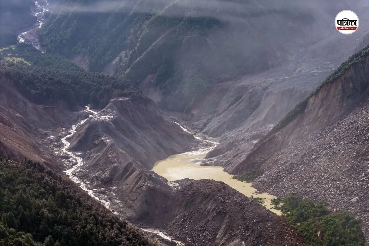
Water levels surging nine meters in just thirty minutes isn't a normal seasonal flood. It is a terrifying wall of destruction. When a massive ice-rock avalanche broke loose high in the Himalayas near the Nepal-China border, it triggered a catastrophic disaster that caught entire communities completely off guard. If you think flash floods only happen after hours of continuous heavy monsoon rain, this event proves how dangerously wrong that assumption is.
The crisis began on a Wednesday morning along the Lhende Khola, a tributary feeding into the Bhote Koshi and Trishuli river systems. Satellite imagery from Planet Labs revealed that a glacier segment roughly the size of twenty-five soccer fields vanished from a cliffside sitting around 5,200 meters up. When that colossal mass of ice and rock smashed into the valley below, it pulverized instantly, releasing a massive wave of water, sediment, and heavy boulders.
The Speed and Scale of the Destruction
Hydrological records show that the surge traveled downstream with terrifying momentum. At Galchchi, the Trishuli River rose by nine meters in half an hour. Malekhu recorded a seven-meter spike over a similar window. Rivers didn't just overflow their banks; they transformed into raging slurry flows that swallowed bridges, roads, vehicles, and hydropower infrastructure.
Districts like Rasuwa, Dhading, and Nuwakot bore the immediate brunt of the catastrophe. Rescue operations quickly revealed a grim reality, with hundreds of people reported missing, including numerous foreign tourists and Indian nationals. Buildings near the border crossing vanished under thick layers of mud and debris within minutes of the initial collapse.
Separating Rumors From Scientific Reality
Initial panic led to quick assumptions that a 4.4-magnitude earthquake had fractured the glacier. However, updated analysis from the U.S. Geological Survey (USGS) and international geoscientists cleared up the confusion. Long-period seismic waves proved that no earthquake triggered the event. Instead, the seismic signals were generated entirely by the massive weight of the collapsing glacier and debris flow.
Experts point out that rising temperatures in high-altitude regions play a major role. As permafrost thaws and meltwater lubricates the base of mountain glaciers, slopes that stood stable for centuries can suddenly fail. It is a stark reminder that cryosphere hazards are accelerating across the highest mountain range on Earth.
What Comes Next for Mountain Communities
The danger doesn't end when the initial wave passes. Scientists are currently monitoring potential secondary hazards, such as temporary landslide dams forming upstream from trapped debris. If these natural blockages pool water and eventually burst, downstream populations face renewed risks.
Governments and local authorities must rethink early-warning infrastructure in high-risk Himalayan valleys. Traditional monitoring systems are built for slow-rising monsoon floods, not thirty-minute walls of ice and mud. If you live, travel, or work near major river basins originating near high-altitude glaciers, staying informed on real-time hydrological alerts is essential for survival. Keep a safe distance from riverbanks during sudden upstream weather shifts, and support disaster preparedness initiatives before the next rapid thaw triggers another crisis.


