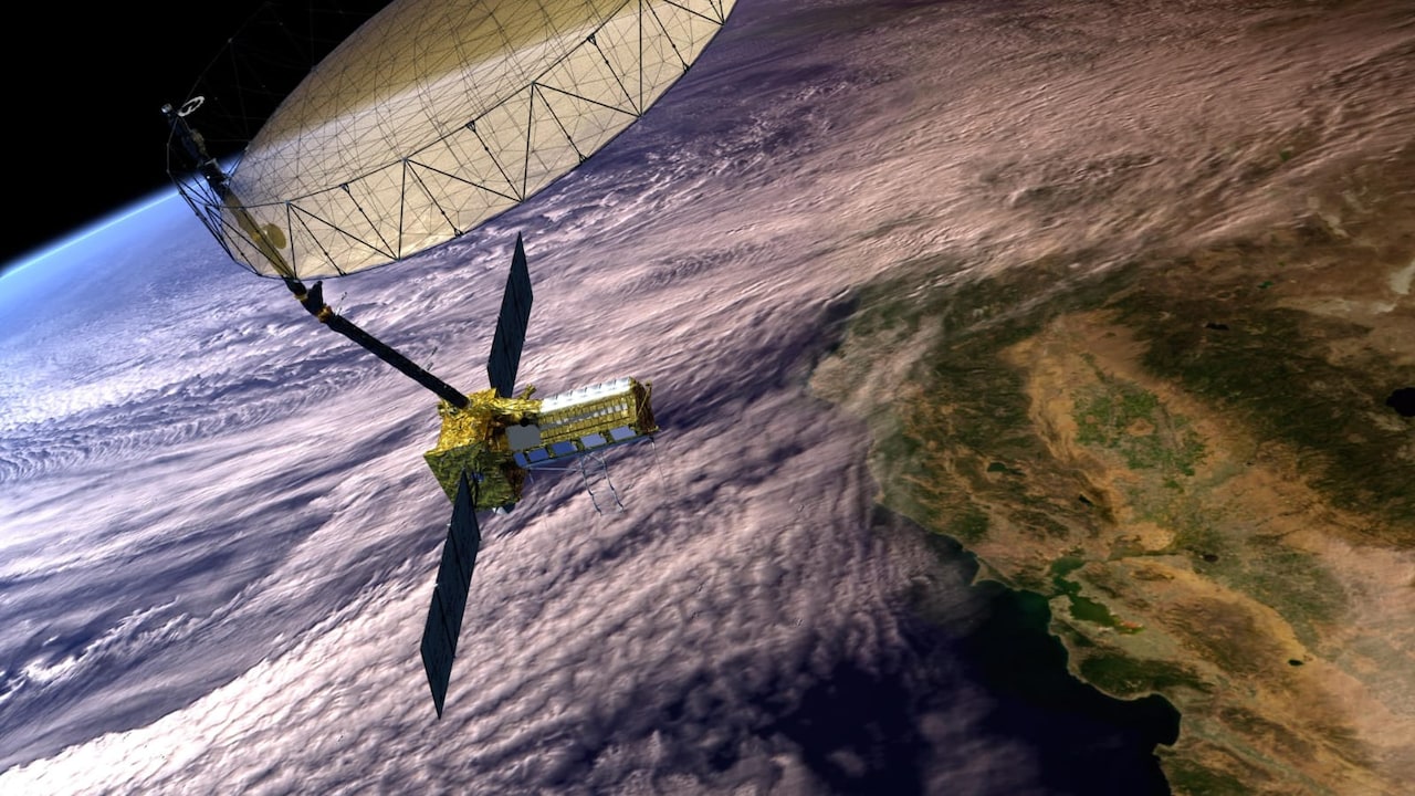
A $1.3 billion orbital radar platform can detect millimeter-scale crustal deformation and glacial lake instability from 747 kilometers above Earth, yet still fail to prevent a single casualty on the ground. The breakdown documented in the recent coverage of the NASA-ISRO Synthetic Aperture Radar (NISAR) mission and disaster events in Nepal is not a sensor failure; it is a classic systems-integration collapse between upstream data generation and downstream institutional execution. When high-resolution Earth observation data meets fragmented municipal governance, low-bandwidth infrastructure, and uncalibrated risk models, the telemetry becomes an expensive post-mortem rather than an operational shield.
Understanding why a premier bilateral space asset detects an impending Himalayan catastrophe without triggering an evacuation requires stripping away the narrative of technological determinism. Building a satellite capable of seeing through monsoon cloud cover solves only the first variable in a four-part disaster-mitigation equation. Unless the remaining three variables—processing latency, bureaucratic translation, and last-mile alert distribution—are engineered to the same standard as the spacecraft's L-band and S-band radar arrays, billion-dollar telemetry will continue to sit unactioned in data repositories while downstream valleys flood.
The Physics and Economics of the Upstream Sensor
To evaluate where the warning chain breaks, you must first isolate what the hardware actually accomplishes. The NISAR observatory represents a massive capital allocation designed to overcome the primary limitation of optical Earth observation in South Asia: persistent cloud cover during the monsoon season and complex topographic shadowing across the Hindu Kush Himalaya.
- Dual-Frequency Radar Architecture: The platform combines NASA’s L-band radar (24-centimeter wavelength) with ISRO’s S-band radar (12-centimeter wavelength). L-band signals penetrate dense forest canopies and glacial snowpack to measure underlying soil moisture and solid-earth movement, while S-band signals capture surface roughness and crop structure with high sensitivity.
- Interferometric Synthetic Aperture Radar (InSAR): By comparing phase differences between radar pulses bounced off the exact same terrain across consecutive 12-day orbital repeat cycles, analysts generate interferograms. These maps measure ground displacement down to fractions of a centimeter, identifying slow-moving landslides, tectonic strain accumulation, and the structural bulging of glacial moraine dams before catastrophic failure occurs.
- Open-Access Data Policy: Unlike commercial synthetic aperture radar constellations that meter high-resolution tasking behind paywalls, NISAR operates on an open-data mandate, pushing terabytes of raw and processed telemetry into public cloud repositories within hours to days of acquisition.
The engineering triumph upstream is unambiguous. From an orbital mechanics and signal-processing perspective, the system eliminates blind spots. However, capital expenditure on orbital hardware frequently creates a dangerous cognitive bias among policymakers: the assumption that observation equals protection.
The Four Bottlenecks of the Disaster Value Chain
In enterprise systems architecture, increasing the throughput of an upstream database without upgrading the downstream APIs simply crashes the receiving servers. Earth observation networks suffer from the exact same structural flaw. The failure to translate satellite detection of Nepal’s geological and hydrological hazards into preventive action occurs across four distinct operational bottlenecks.
1. The Temporal Latency Gap
Orbital mechanics dictate revisit times. NISAR images nearly every point on Earth's land surface twice every 12 days (once on an ascending pass, once on a descending pass). For slow-onset hazards—such as tectonic strain along the Main Himalayan Thrust or gradual subsidence in the Kathmandu Valley—a 6-to-12-day cadence provides high diagnostic value.
Rapid-onset cascades operate on a completely different clock. Glacial Lake Outburst Floods (GLOFs), cloudburst-induced debris flows, and co-seismic landslides often transition from initial structural destabilization to valley-floor impact in minutes or hours. If a moraine dam begins rapid piping failure 48 hours after an orbital pass, the satellite will not capture the acceleration until ten days after the downstream settlements have been destroyed. Even when the satellite captures pre-failure deformation on schedule, the pipeline from downlink to interferometric processing, quality control, and scientific verification frequently consumes days—erasing the lead time needed for physical evacuation.
2. The Raw-Telemetry Translation Deficit
Space agencies deliver geophysical measurements, not operational instructions. An interferogram showing three centimeters of phase shift along a steep slope in Solukhumbu or Rasuwa is mathematically precise, yet operationally useless to a district disaster management officer.
Converting raw SAR phase data into a binary evacuation order requires specialized geotechnical modeling, digital elevation models (DEMs) of matching resolution, and local hydrological baselines. In Nepal, the institutional capacity to ingest multi-terabyte SAR datasets and run automated change-detection algorithms in near-real-time remains concentrated within a small cohort of academic researchers and international consortia rather than embedded inside municipal emergency operations centers. Without automated translation layers that convert geophysical anomalies into probabilistic hazard maps, the data remains trapped inside scientific workflows.
3. Jurisdictional Fragmentation and Accountability Diffusion
Following the promulgation of its 2015 constitution, Nepal transitioned to a federalized governance model comprising federal, provincial, and 753 local municipal governments. While decentralization theoretically places decision-making closer to vulnerable communities, it has created severe jurisdictional ambiguity in disaster risk reduction.
- Upstream Ownership: Orbital data agreements, bilateral space agency partnerships, and national meteorological departments sit at the federal level in Kathmandu.
- Downstream Execution: Evacuation orders, road closures, and local shelter management fall under the mandate of under-resourced rural municipalities (Gaunpalikas) and District Disaster Management Committees.
- The Accountability Vacuum: When an international satellite flags a "moderate-to-high probability" of slope instability, no clear statutory threshold compels a local official to order a costly, disruptive evacuation. Issuing a false alarm carries immediate political and economic penalties—halting tourism, disrupting agriculture, and eroding public trust. Ignoring a probabilistic satellite warning carries no immediate penalty until the low-probability, high-impact event actually materializes. Faced with asymmetric incentives, bureaucratic systems default to inaction.
4. Last-Mile Infrastructure Fragility
The final failure point lies in physical communications and terrain geometry. Himalayan valleys are acoustic and radio-frequency dead zones. Even when federal hydrologists identify an imminent threat and issue an alert, transmitting that signal to isolated settlements along narrow river gorges encounters severe physical friction.
Cellular networks in high-altitude districts frequently rely on single-point-of-failure microwave relays or low-capacity power grids that fail during the exact monsoon storms that trigger landslides and floods. Furthermore, standardized alerts sent via SMS or mobile applications fail to account for linguistic diversity, literacy rates, and the physical reality that residents living in steep terrain often lack safe, accessible evacuation routes during active precipitation. An alert that arrives without a pre-engineered vertical evacuation path merely informs residents of an unavoidable impact.
The Structural Flaw in Space-Based Aid Economics
The disconnect between a $1.3 billion orbital asset and a vulnerable Himalayan village exposes a persistent distortion in international development and technology financing. Donor nations and space agencies face strong institutional incentives to fund capital-intensive, high-visibility hardware projects. A bilateral satellite launch generates diplomatic prestige, aerospace manufacturing contracts, and quantifiable scientific output.
Conversely, funding the ground-level plumbing required to make that satellite useful offers low political visibility and high operational friction. Maintaining automated river-gauge telemetry, training municipal engineers in SAR data ingestion, mapping localized landslide runout zones, and building redundant community siren networks require continuous operating expenditure (OpEx) rather than one-off capital expenditure (CapEx). Because international financing heavily favors CapEx over OpEx, the global Earth observation ecosystem is saturated with high-resolution sensors feeding into underfunded, manual response architectures.
| System Layer | Primary Custodian | Capital Allocation | Operational Bottleneck |
|---|---|---|---|
| Orbital Acquisition | Bilateral Space Agencies (NASA/ISRO) | Extremely High ($1.3B+) | Fixed 12-day revisit orbital geometry |
| Data Processing | Cloud Repositories & Research Institutes | Moderate | Multi-day latency between acquisition and analysis |
| Risk Translation | Federal Ministries & NGOs | Low | Lack of automated probabilistic trigger thresholds |
| Last-Mile Action | Rural Municipalities & Local Communities | Severely Underfunded | Power/telecom fragility and absence of evacuation routes |
Limits of Orbital Remote Sensing
Relying on synthetic aperture radar as a primary early warning mechanism carries inherent physical and operational limits that no software upgrade can completely eliminate.
First, geometric distortion in extreme relief degrades SAR accuracy. Side-looking radar imaging over steep Himalayan topography suffers from foreshortening, layover, and radar shadow. Depending on the slope aspect relative to the satellite’s orbital track, critical unstable rock faces can be completely obscured from the sensor's line of sight.
Second, atmospheric water vapor delays introduce phase noise into interferograms. During peak monsoon conditions—precisely when landslide and flood risks peak—dense tropospheric water vapor alters the propagation speed of radar pulses, creating false deformation signals that require complex atmospheric correction models to filter out.
Third, probabilistic ambiguity cannot be engineered away. Satellite telemetry measures precursor indicators—surface creep, soil saturation, lake area expansion—not the exact moment of structural failure. False positives are mathematically guaranteed if thresholds are set low enough to catch every catastrophic event.
Re-Engineering the Warning Pipeline
Closing the gap between orbital detection and ground survival requires shifting investment and engineering discipline from the spacecraft to the municipal edge. Space agencies, federal disaster authorities, and multilateral development banks must execute four structural adjustments:
- Deploy Automated Edge-Trigger APIs: Stop delivering raw interferograms to emergency managers. Space agencies and cloud providers must fund automated processing pipelines that ingest NISAR telemetry, cross-reference it against high-resolution digital elevation models and rainfall forecasts, and output standardized Common Alerting Protocol (CAP) triggers whenever deformation velocity crosses pre-calibrated thresholds.
- Pair Orbital Sensors with In-Situ Telemetry: Use NISAR’s wide-area mapping to identify the top 5 percent most unstable glacial lakes and creeping slopes, then instrument those specific high-risk sites with ground-based extensometers, piezometers, and ultrasonic water-level sensors. Ground sensors provide the second-by-second temporal resolution that a 12-day orbital pass cannot match.
- Establish Pre-Authorized Evacuation Thresholds: Eliminate bureaucratic hesitation by replacing discretionary decision-making with automated, rule-based triggers. Federal and municipal authorities must codify specific combinations of satellite deformation data and ground rainfall metrics that automatically initiate staged evacuations, insulating local officials from political blowback during false alarms.
- Harden Last-Mile Broadcast Channels: Decouple emergency alerts from commercial cellular networks in high-risk valleys. Mandate solar-backed VHF radio networks, automated acoustic sirens tied directly to upstream river gauges, and offline mesh communication nodes across vulnerable mountain corridors.
Until funding parity is established between orbital sensors and ground-level execution, space-based early warning systems will remain an observational luxury—capable of documenting disasters in exquisite millimeter detail, while watching them unfold unchecked.