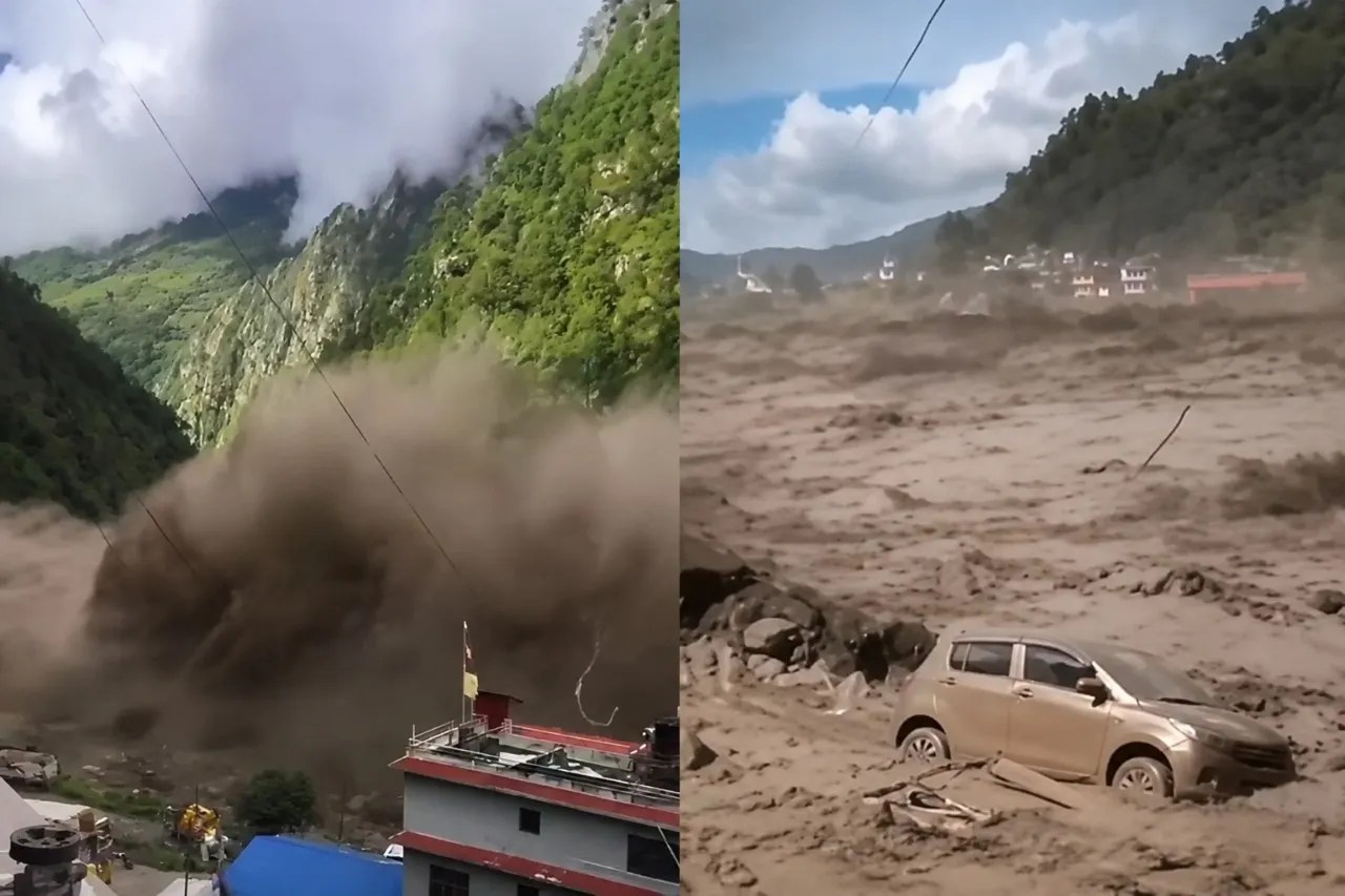
The water did not arrive with the slow, measured swell of a seasonal monsoon. It arrived like liquid concrete, a suffocating slurry of pulverised ice, mud, and boulders moving with terrifying speed down the Bhote Koshi valley. When the wall of destruction struck the borderlands between Nepal and Tibet, it swept away multi-storey concrete buildings and dozens of hydropower projects as if they were made of balsa wood.
Centres of calculation in Kathmandu and international scientific bodies are now racing to understand the true anatomy of the catastrophe that claimed hundreds of lives and left hundreds more missing. More urgently, hydrologists tracking the upper basins are warning that the danger has not passed. An ongoing blockage upstream leaves the region exposed to the immediate threat of a second flood.
The Anatomy of a Ghost Wave
Initial frantic dispatches blamed the disaster on a subterranean tremor. Monitors picked up seismic signals, and authorities floated the hypothesis of a magnitude 4.4 earthquake that had triggered a destructive hillside landslide.
That hypothesis collapsed under closer scrutiny. Subsequent analysis of long-period seismic waves by the United States Geological Survey revealed a different reality entirely. There was no tectonic earthquake. Instead, the seismic energy was generated by a colossal glacial collapse and debris flow.
High-resolution satellite imagery captured the smoking gun high in the Himalayas. A glacier looming above a narrow valley had fractured, calving a massive section roughly equal to the area of twenty-five professional soccer fields.
A mountain of ice thousands of feet high lost its footing, driven by destabilised permafrost and relentless thermal stress. As the ice mass plummeted into the valley floor, it smashed into smaller fragments and mixed with accumulated meltwater, creating a high-energy avalanche that briefly dammed the Lhende River.
When that temporary natural dam failed, it released a catastrophic pulse downstream. Water levels in regional rivers spiked by nearly thirty feet in less than thirty minutes.
Why Standard Warnings Failed
Traditional disaster management systems across South Asia rely on a specific sequence. Rain falls. River gauges rise. Sirens sound. Communities evacuate.
That playbook is entirely useless against high-altitude cryo-hydrological events. Experts note that the catastrophic surge occurred with virtually no prior rainfall in the immediate basin.
That single factor defeats almost every operational flood warning system deployed globally. Without precipitation to track, automated telemetry networks registered clear skies right up until the moment the mountain fractured.
When a wall of mud and water moves at high speed through a narrow gorge, survival mathematics become brutally simple. Running on foot or attempting to escape by vehicle is a fatal miscalculation. The velocity of the debris front leaves zero margin for error.
Field specialists emphasize that standard evacuation routes often run parallel to river corridors, directly into the path of the torrent. The only viable defense in these steep topography zones is vertical flight, scrambling up rocky slopes to a safe height of at least twenty feet above the valley floor the instant anomalous ground vibrations or unusual river sounds are detected.
The Warming Roof of the World
The disaster along the Nepal-Tibet border is not an isolated anomaly. It is part of a worsening structural trend across the Hindu Kush Himalaya, a mountain system warming at nearly twice the global average.
As regional temperatures climb, ice-loss rates across the range have roughly doubled compared to historical baselines. Permafrost thaws, leaving steep rock and ice faces structurally compromised. Glaciers retreat, leaving behind unstable moraine walls and hanging chunks of dead ice prone to sudden structural failure.
This is the grim reality of elevation-dependent warming. A 2026 assessment of the region documented a massive expansion in the number of high-altitude glacial and supraglacial lakes. These bodies of water are ticking time bombs, held back by fragile barriers of loose rock and ice.
Similar tragedies have struck with increasing frequency. A glacial outburst flood surged through the exact same valley region the previous year, while other sectors of the Himalayas have experienced deadly ice-rock avalanches that caught regional planners flat-footed.
Living Under a Dam of Ice
The immediate priority for rescue crews remains locating the hundreds of missing travellers, pilgrims, and local residents whose last known whereabouts intersected with the path of the torrent. Yet behind the search operations lies a deeper policy failure.
Governments throughout the Himalayan arc have consistently underestimated the speed at which high-altitude cryosphere risks are evolving. Infrastructure projects, including hydropower installations and cross-border transit routes, are frequently designed around twentieth-century hydrological assumptions that no longer apply to a rapidly destabilising mountain landscape.
Mitigating future disasters requires a complete overhaul of monitoring architectures. Simple rainfall gauges are no longer enough. Scientists advocate for real-time seismic monitoring of high-altitude ice masses, coupled with automated river-level sensors that can relay instantaneous anomaly alerts to downstream settlements, buying precious minutes of warning time.
Until those systems are built and integrated across international borders, communities living beneath the roof of the world remain at the mercy of the next invisible fracture high above the clouds.