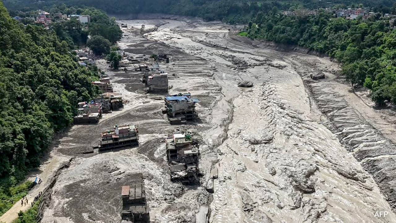
Catastrophic environmental failures in mountainous terrain are rarely simple meteorological events; they are complex hydraulic shocks driven by high-altitude cryospheric triggers. When a glacial collapse occurs at an altitude exceeding 5,000 meters, the resulting cascade of ice, rock, and water transforms standard river valleys into high-velocity debris flows. Examining the mechanics of the flash floods along the Nepal-China border reveals a predictable sequence of structural overload, hydraulic pressure multiplication, and infrastructure vulnerability that traditional news reporting frequently reduces to human-interest fragments.
The Cryospheric Trigger Mechanism
Standard seasonal floods are driven by precipitation volume accumulation over extended windows. The event along the Bhotekoshi and Trishuli river corridors operated on an entirely different physical model. Satellite telemetry and geological surveys confirmed that the initial catalyst was an ice-rock avalanche originating from a destabilized glacier shelf at approximately 5,200 meters.
The mechanics unfold through three distinct phases:
- Mass Dislodgment: A massive volume of glacial ice and moraine detritus shears off a steep slope, registering as a magnitude 5.2 seismic event due to the sheer kinetic energy of impact.
- Valley Choke and Damming: The debris descends thousands of meters into narrow gorges, temporarily blocking tributary channels such as the Lhende Khola. This creates an unstable natural impoundment barrier.
- Catastrophic Outburst: The ephemeral dam fails under hydrostatic pressure, releasing a wall of water and slurry that increases river volume dramatically within a compressed timeframe. Hydrological monitors noted water levels surging by up to nine meters in under thirty minutes.
This hyper-accelerated discharge velocity invalidates standard flood warning models, which rely on cumulative rainfall gauges rather than cryospheric instability sensors.
Infrastructure Vulnerability Indexes
The geography of Himalayan transit corridors forces roads, settlements, and hydropower stations into narrow river valleys—the exact zones dictated by hydraulic flow dynamics. When a high-volume debris surge occurs, the built environment experiences total structural failure across multiple dimensions.
Bridges and roadways situated along these gorges function as structural bottlenecks. With nearly forty kilometers of roadways and multiple bridges washed away in a single morning, regional connectivity collapses instantaneously. Vehicles operating within these corridors become liabilities rather than assets; survivors recounting scenes where dozens of vehicles vanished behind them highlight the fatal interaction between vehicle transit speed and rising water fronts.
The kinetic energy of a debris flow carrying boulders and glacial ice scales exponentially with velocity. Conventional civil engineering standards for retaining walls and highway embankments in the Hindu Kush Himalayan region are calibrated for standard monsoon thresholds, not 27-million-cubic-meter mass movements. Consequently, commercial transport hubs, customs yards, and hydropower generation infrastructure face systemic wipeouts because their location coefficients prioritize trade route efficiency over low-probability, high-magnitude tectonic and cryospheric risks.
Regional Risk Propagation and Transboundary Management
Disaster management in the Hindu Kush Himalaya suffers from a structural coordination deficit across national jurisdictions. Glacial systems do not respect political boundaries between China, Nepal, and India, yet early warning data often remains siloed behind national agencies.
The mechanics of transboundary flood propagation dictate that a hazard originating in high-altitude Tibetan territory impacts downstream Nepalese settlements within hours, while secondary hydrological pulses affect northern Indian plains days later. When multi-nation responses are initiated post-disaster—such as deployment of military rescue helicopters and international diplomatic requests for emergency teams—the latency period undermines survival curves for stranded tourists and local populations.
Regional warming trends compound these vulnerabilities. Scientific assessments indicate that glaciers in the Hindu Kush Himalaya are disappearing at accelerated rates, forming unstable supraglacial lakes and over-steepened slopes. As the cryosphere destabilizes, the frequency of glacial lake outburst floods and ice-rock avalanches increases.
Strategic Resilient Infrastructure Blueprint
To transition from reactive disaster rescue to predictive hazard mitigation, regional authorities must implement a multi-tiered structural overhaul:
- Deploy automated high-altitude acoustic and seismic sensors directly below high-risk glacier shelves to detect mass movements prior to valley entry.
- Relocate permanent transport and economic infrastructure above the maximum historical hydraulic surge line, abandoning vulnerable gorge floors.
- Establish real-time, cross-border telemetry data-sharing agreements between meteorological and geological agencies in Beijing, Kathmandu, and New Delhi to eliminate information latency.
- Mandate structural engineering retrofits for all existing hydropower facilities in high-risk seismic zones, incorporating bypass channels to safely route sudden debris surges away from turbine houses.


