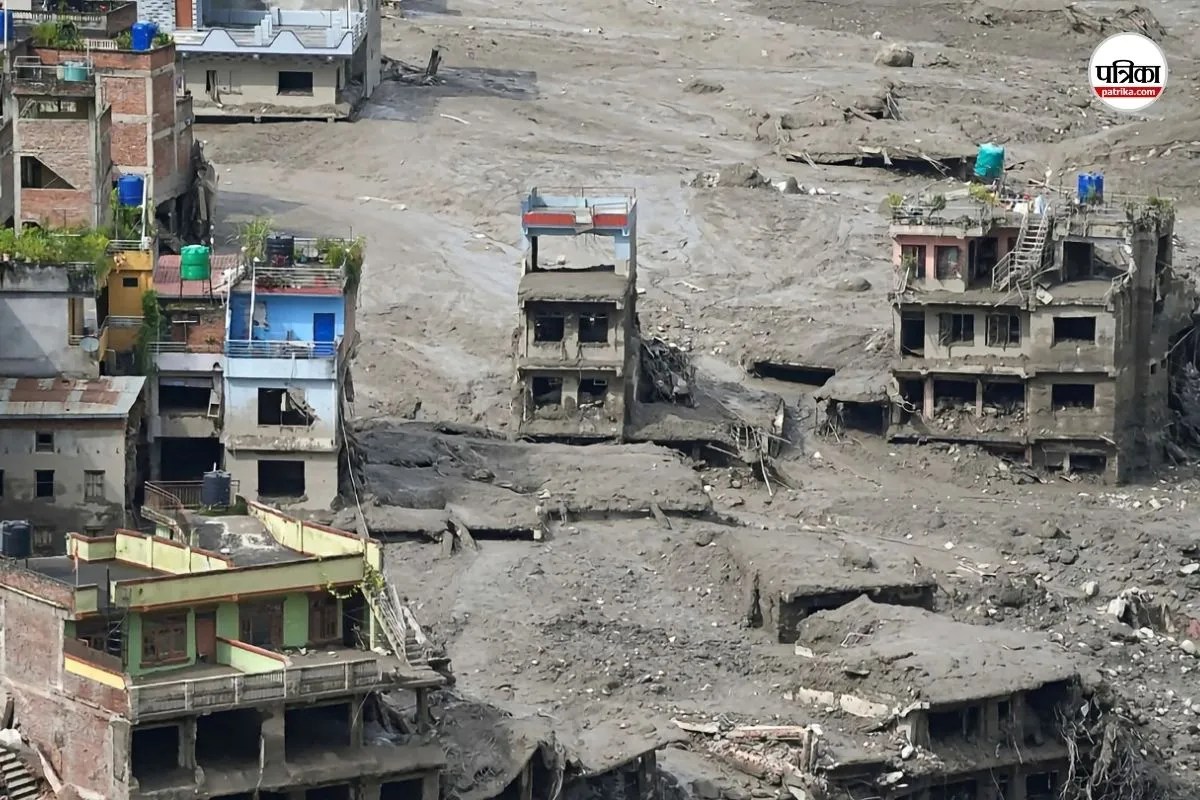
Standard media coverage of the recent flash flood along the Nepal-Tibet border reduces a complex geophysical failure to a surface-level narrative of human tragedy and vague meteorological misfortune. Reports typically point to heavy rains or general climate deterioration, offering little structural insight into how a remote high-altitude incident translates into a devastating downstream hydraulic surge. Deconstructing the event requires analyzing the cascading physical variables that transform static glacial mass into an ultra-high-velocity debris torrent capable of bypassing traditional early warning thresholds.
The Physical Mechanics of the Cascade
The disaster originated not from ordinary rainfall, but from a high-altitude structural failure of a mountain glacier near the border. Satellite telemetry and seismic analysis confirm that a massive segment of ice and rock—estimated to cover approximately two million square feet—detached at an altitude exceeding 5,000 meters and plunged more than 1,200 meters into the valley below. For an alternative look, see: this related article.
This event operated through a specific three-stage cascading mechanism:
- Gravitational Potential to Kinetic Conversion: The sudden detachment of ice converted immense gravitational potential energy into a high-velocity ice-rock avalanche, pulverizing solid matter and generating a seismic signature initially misread by remote sensors as a 5.2-magnitude earthquake.
- Temporary Impoundment and Hydraulic Head: As the avalanche material cascaded into the narrow gorge of the Lhende Khola and Bhote Koshi river systems, it formed a massive, unstable temporary dam across the channel. Water accumulated behind this natural barrier, creating an escalating hydraulic head.
- Catastrophic Dam Failure and Surge Propagation: The sudden breach of this debris dam released an intense wall of water, sediment, and pulverized ice. Hydrological data from the International Centre for Integrated Mountain Development indicates that the Trishuli River rose by nine meters within a thirty-minute window at downstream monitoring points.
Topographical Amplification and Economic Vulnerability
The destructive force of the flood was multiplied by the unique geomorphology of the Himalayan corridor. Narrow, steep-sided river gorges act as natural hydraulic flumes. When a massive sediment load—comprising boulders, glacial till, and soil—mixes with water, the fluid density increases dramatically. This turns a standard water flood into a dense debris flow with exponentially higher kinetic energy and destructive potential. Further insight regarding this has been published by BBC News.
Human settlement patterns intersect directly with these physical hazards. Habitable flat land in the high mountain corridors is severely constrained, forcing infrastructure, human settlements, tourism routes, and hydropower facilities to cluster tightly along river terraces. The destruction of critical transport links, such as the Gyirong Port logistics hub and multiple bridges along the Rasuwagadhi corridor, demonstrates the fragility of linear infrastructure built within high-risk mountain drainage basins.
Systemic Limitations in Hazard Mitigation
Traditional disaster management frameworks in high-altitude zones rely heavily on meteorological forecasting, tracking rainfall totals and monitoring known glacial lake outburst flood sources. However, dry-initiation ice-rock avalanches bypass standard precipitation-based early warning triggers entirely. Because the failure occurs due to internal thermal degradation of permafrost and sub-glacial melting rather than active storms, lead times are effectively zero.
This limitation exposes a critical gap in regional risk architecture. Monitoring systems must evolve beyond simple rain-gauge networks and glacial lake level sensors to incorporate real-time satellite radar interferometry, continuous seismic monitoring for mass-movement detection, and automated acoustic flow sensors positioned in upper riverine catchments.
Deploy heavy-lift aerial assets and deploy autonomous subsurface acoustic monitors along high-risk trans-boundary river corridors to establish sub-minute anomaly detection before hydraulic surges reach populated low-altitude settlements.


