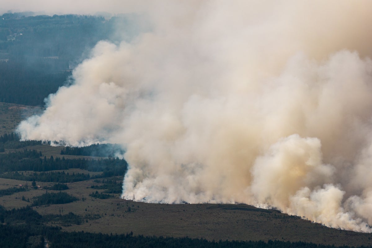
Unprecedented dry spells transform delicate regional ecosystems into high-velocity combustion zones. When a blaze ignited within the High Fens nature reserve along the Belgian-German border, it expanded from an 80-hectare incident to over 3,000 ravaged hectares in under seventy-two hours. This expansion rate highlights critical vulnerabilities in European terrestrial defense infrastructures, exposing structural limits in terrain accessibility, sub-surface peat combustion dynamics, and trans-national emergency coordination.
The Fuel Vector and Sub-Surface Burn Mechanics
Traditional wildfire analysis focuses on surface canopy fuel loads, but the High Fens crisis demonstrates a subsurface failure mode. The reserve consists primarily of moorland, peat bogs, and dense pine stands. Peat acts as a dense, carbon-rich subterranean fuel source that retains thermal energy long after surface flames are suppressed.
The combustion cycle operates through three distinct stages during prolonged droughts:
- Desiccation Phase: Extended high temperatures evaporate interstitial water from the organic soil matrix, reducing moisture content below critical thresholds.
- Pyrolysis Propagation: Surface ignition transitions downward, allowing fires to smolder underground undetected by aerial thermal imaging until oxygen availability triggers breakout points.
- Micro-Meteorological Feedback: Localized thermal updrafts generate erratic wind shifts, accelerating surface flame propagation speeds across flat, exposed heaths.
The terrain's topography restricts heavy mechanized intervention. Conventional fire engines cannot traverse water-logged or uneven peat beds without risking immobilization, forcing tactical reliance on perimeter defense rather than direct frontal assault.
The Evacuation Logistics Matrix and Human Displacement
As the perimeter expanded toward the municipalities of Waimes and Bütgenbach in Liège province, regional authorities ordered the precautionary evacuation of approximately 600 residents alongside tourists. The logistical chain governing these displacements exposes the friction points of municipal disaster response:
- Information Propagation Latency: Rapidly shifting wind vectors compressed the window between initial threat detection and mandatory displacement orders, leading to localized bottlenecks on secondary access roads.
- Shelter Allocation Constraints: Municipal infrastructure relied on converted gymnasiums in Malmedy to absorb displaced populations, underscoring a deficit in modular, short-term civic sheltering designed for extended rural evacuations.
- Interface Zone Vulnerability: Residential pockets embedded within forest-agricultural borders lacked adequate defensible space clearances, forcing emergency personnel to divert suppression assets from perimeter containment to structural protection.
Trans-National Resource Allocation and Structural Interoperability
Because domestic firefighting assets were overwhelmed by the sheer spatial scale of the fire, Belgium activated the European Union Civil Protection Mechanism. This intervention framework illustrates both the efficacy and the administrative friction of collective continental response protocols.
Deployment metrics involved specialized assets from multiple jurisdictions, including Swedish water-bombing aircraft, Czech and Dutch helicopters, and ground support units dispatched from neighbouring Germany and Luxembourg. However, cross-border deployment introduces operational friction:
- Command Disparities: Integrating disparate national command structures, communication frequencies, and tactical doctrines creates operational lag during the initial 24 hours of multi-state deployment.
- Logistical Supply Chains: Aerial firefighting assets require continuous replenishment of fuel and retardants, straining regional logistical hubs that were not engineered for sustained, high-volume multi-sortie campaigns.
Deploy heavy tactical trenching units along pre-mapped firebreaks adjacent to high-risk peat basins before seasonal moisture deficits reach critical thresholds, while codifying automated cross-border command protocols to eliminate operational latency during multi-state mobilizations.
Wildfire Tears Through Belgium's Largest Nature Reserve
This video provides a visual overview of the terrain and scale of the emergency response in Belgium's largest nature reserve.
http://googleusercontent.com/youtube_content/1

:max_bytes(150000):strip_icc()/lake-mead-173940030-5c25228846e0fb00014e8584.jpg)
